
You know you are in a remote location when there are two buses a day, one at 7 am and one at 4:30 pm, such is the case with travelling to Åkeholm. I alighted from the bus along with the only other passenger in a 60 seater bus. The lady walked across to her car, I just walked knowing that the campsite for the night was about a km away. It was a beautiful warm night though I knew there was some rain predicted for the next two days. arriving at the shelter site I chose a place a little distance away from the shelter with a view of the the rapidly flowing Mörrumsån, it seemed like an ideal place for a Tenkara, maybe next time. I set about putting the the DuoMid up, getting the stove going and generally settling in for the night.

After a pleasant and quiet evening only punctuated by the sound of the rapidly flowing river I retired to my solo inner net within the duomid.
I woke up the next morning and looked outside to be greeted by a man asking me where was it legal to fish? I don't know was my reply and then he said maybe those people will know, I looked around to see a leanto tent with 5 people inside as well as 3 vehicles (all danish) and on closer inspection 5 people asleep in the shelter and about 80 full cans of beer stacked next to the shelter. Their canoes were still sitting on the trailer, but to be fair I never heard them at all that night, the next night could be a another story.
I set about having a leisurely breakfast, followed by packing up and headed off with most of the canoeists still sound asleep. As I followed the trail along the river it became evident that it was a popular fly fishing area with several cars and fisherman, the season goes from March 1 to September and you are allowed to catch only 2 salmon a day ( I would be happy with one).

As I turned a corner I noticed two large birds, it took me a moment to realise they were most likely a pair of storks, once they had seen me they gracefully flew away, a wonderful site ( a first for me).
After the sighting of the storks I continued wandering along the roads and trails to Kåringahejans naturreservat, where once again the Mörrumsån flowed powerfully through a gorge before opening out into flatter country, the trail finally met up with an old railway line, now a cycle path which took me across the river and from there it would be a climb away from this wonderful river.

I followed the trail through the forest before coming to Röshult with the remnants of many old buildings along with the blacksmiths oven, it was about this time that I began to notice that it was getting gloomier.

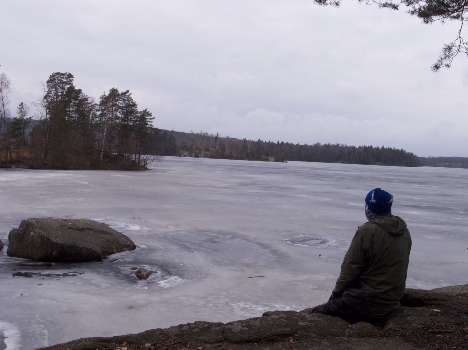
Soon after I crossed a main road with a bus stop nearby (always useful to know) before heading to Bredasjön, and lunch, originally I had planned to camp there but the wind was blowing of the ice on the lake and campsites were non existent along with no flowing water so I decided to continue for another 12 km to Slagesnäs.

After lunch it became increasingly gloomy and I knew I was going to get wet when there was a loud clap of thunder followed by a down pour of rain. The downpour continued for about 4 hours with the wind increasing and the wind blown rain finding every nook and cranny of my gear. It was two hours before I reached the shelter for the night and at that time the lake was about 2 metres from the shelter, I decided the shelter was the best option for the night and I set about the usual camp chores as the rain continued to pound down on the roof, with the occasional branch being blown down as well. My waterproof gear Haglöfs Oz Pullover and Paramo Velez Adventure Trousers were okay but in both cases there was some leakage, I will write about that later. However, I was using a borrowed Aarn Natural Balance Pack with a waterproof liner and not one thing inside the pack was a damp, you can visualise a smile here. However, I did wonder how the canoeists fared, no doubt getting wet was not an issue but I could not see the leanto tent lasting long, I guess I will never know.

I awoke the next morning to find the water lapping at the sides of the shelter, it had risen about 5 cm over night which with a lake about 1 km in length and half a km wide indicates there was a lot of water flowing into the still frozen lake.

After packing and heading off I realised that the trail was to follow the outlet of the lake and then I begun to wonder if I was going to able to get through the narrow flooded valley.

The trail in the most part did stay just above the flood line as it headed south, there was a couple of bridges which were used to cross the fast flowing river and I was very appreciative of the work done by volunteers and kommunes to maintain and build such bridges, without which it would have been very difficult to get to the other end of the valley in such conditions.

Climbing out the valley the trail takes you through open forest as well as crossing a railway line before arriving at the northern end of Halen, a large lake on the western side of Olofström. The trail skirts the Western flank of Olofström before passing through a caravan park and then returning to the forest. I did wonder if ice axes were advised when using the diving board during winter.

Further along the lake there is a large rocky outcrop overlooking the lake as well as a day picnic shelter and a shelter, it was evident that this area was very popular in warmer weather but for now I had the place to my self.
After a climb and a descent as the rain begun to fall I reached the southern end of Halen, it too showed signs of being well used but I was able to find a spot overlooking the lake and watched the sun disappear over the horizon and the changing shades of blue on the ice as nighttime took control.


The following morning was to be a short day much of which was over familiar ground of the Kust to Kustleden, however, there was surprise left in store a hazy view of Halen from a cleared hill as I climbed away from the campsite.

As I approached the end of the trail I passed what could be best described as two black boxes facing each other across the trail, I can only assume they were some form of counter, interesting.

The final section led me across the bridge over flood swollen Holjeån river, reminding me once again of the importance of the work done by many people to allow us to walk the hills.


