Showing posts with label Nordsøstien. Show all posts

Monday, 14 February 2011

Blowin away

Alighting from the train I headed into Tornby Klitplantage and set up camp for the night it had been a cold clear and calm sunny day, sadly for me most of the day had been spent on the train.


The following morning I awoke to an ice encrusted shelter, having had breakfast I set off on the frozen ground towards the coast as the clouds gradually built with a breeze strengthening. I crossed Liver Å on the bridge and it was evident that any moisture in the sand had frozen whilst evidence of sand slips above the bridge ensured that every step was taken with care.


The trail took me through many summer house areas as it skirted the coast line and with the wind increasing the sun covered in cloud there was little time to hang around, it was cold. Finally descending and then walking along the beach to Lonstrup before heading through this quiet windswept village and once again turning south west towards the highlights of the days walk.


The coastline here is subjected to the force of the wind and the North Sea and as a result the coast line is forever changing and with many buildings gradually getting closer to the cliffs and ultimately disappearing. Such is the case with Mårup church originally built in the 1200's about a kilometre from the sea, it is now less than 10 metres from the sea.


To the south of the church lies Rubjerg Knude and accompanying light house, as I climbed to the top of the dune the windswept sand ensured that my face was kept buried in my Tuara.


Fortunately much of the sand was frozen and as such it was not too bad, I can however imagine the sand storms that must rage through this area at times.


The sand around the lighthouse was hollowed out making a veritable wind tunnel and it was interesting to see that the lighthouse originally built in 1899 was surrounded by outbuildings but now only the tower remained. The lighthouse was decommissioned in 1968 and the fight against the sand drifts was given up in 2002, once again demonstrating the power of nature.


Leaving the sand dune the trail descended into the peaceful sheltered tranquility of a small forest, it was here, sheltered from the wind, I had lunch.

The afternoon took me through Nørre Lyngby another town threatened by the encroaching sea.

Leaving Nørre Lyngby the trail followed the sea and I slipped and slid over many large ice patches on the sand (should have packed my micro spikes) while there was more evidence of the power of the sea over man made structures.


The cliffs provided some respite from the wind, however, it was evident that the wind was increasing and the accompanying windchill ensured the temps were dropping into the the negatives teens I decided that it was time to find a sheltered spot for the night and a small cabin seemed ideal. Having booked into the cabin, on the outskirts of Løkken, with forecasts of wind speeds ranging between 15 and 20 metres per second for the coming days and with temps below zero combined with a possible reoccurrence of an old injury I felt it was time to head home.

Some gear observations, the Haglöfs Ozo Pullover was perfect for such conditions and it has possibly the best hood of any jacket I have used.

The MLD Speed mid is an ideal size for one and provides enough space should the weather turn bad, this will be going on more trips.

For the trip I used the Snowpeak Gigapower Ti Stove and I used 20 gms of gas per litre of water.


I will be back, as there are many more beaches to walk.


Sunday, 24 October 2010

To the Top End along the Nordsøstien


I attended a family christening (Barnedåb) before commencing my travels to Jutland. Interestingly Danish Railways (DSB) were offering a special on upgrades to first class and I decided to try it. Apart from an endless supply of coffee, fruit, biscuits and water, the peace allowed me to read Erin and Higs book The long trek home a wonderful book about the environment, conservation and the will to survive, a book I very much recommend. I alighted from the train at Tornby at 5:30 in the evening and with a 3 km walk to the campsite I quickly set off to make the most of the remaining daylight. Passing through the outskirts of Tornby I noted that there were several people out for a walk in the pleasant evening light. No doubt some of them wondered why there was a backpacker heading out of town at this hour of the evening. I soon entered the forest which was a mixture of pine and beech and arrived at the shelter place where I intended to camp, finding a nice spot in the lee of the trees I quickly set up my Trailstar and settled down to cook dinner and enjoy the moonlit evening. Soon I was in bed eagerly anticipating the coming days walk which would take me to the top of Jutland.


There was some rain during the night and the morning brought with it grey skies and with the prediction of rain late in the day I soon set off towards the coast and the Hirtshals.


The trail firstly took me towards the coast before heading inland through the forests of Tornby Klitplantage before returning to the coast at Tornby Strand. Following the trail along the coast I soon arrived at Hirtshals Fyr (lighthouse) which provides wonderful views of Hirtshals as well as bunkers from the second world war.


Descending into Hirtshals the rain began to fall as I passed by the port with its collection of fishing vessels as well as ferries bound for Norway.


I was happy to leave Hirtshals and continue my trek north through Lilleheden Klitplantage with its autumn colours and still waters.


The trail paid a brief return visit to the coast at Uggerby Strand with its broad firm sand providing easy walking along with access for motor vehicles.


I returned inland to follow the forested paths past the Uggerby Tårn (tower) before arriving at the campsite adjacent to Uggerby Å. The campsite consisted of space for 2 small tents a bench and a small fireplace, it was sheltered from the wind and it was soon evident that the trailstar would accumulate condensation. No sooner was camp set up, the rain started which persisted all night so the following morning after the rain had ceased I was left to pack a very wet shelter. It appeared that the weather may improve and the first views of Tannisby strand were further evidence of a good day.


With the sun only just rising the lighting on the sand dunes provided wonderful contrast of colours, light and shadows.


I was soon on the beaches and there were many different patterns brought about by the water such patterns endured ensuring that the walk was always interesting as every step brought a new perspective on the landscape.


Passing by the popular tourist spot of Tversted Sø where the ducks were eager to be fed I headed into Tversted Klitplantage, the oldest plantation in Northern Jutland. As I approached Østerklit Stokmølle (windmill) I entered a camping area and much to my surprise there was a Sauna, this was the first time I had found a sauna in Denmark, it provided ideal shelter as the rain poured down for the next hour while I ate lunch.


As the rain eased I set off to the windmill and was pleased to find that not only was it open but there was an audio display in 3 languages.


For a while the trail continued through the forest before finally returning to the beach, which would be followed for the next 8 km or so. It was a pleasant walk, with little wind, firm sand and I was entertained by all the variety that can be found on a beach, such as rainbows.


Windblown sand dunes.


Sand, sea and clouds.


As I departed the beach the sun was beginning to set and with one last look along the beach I climbed back into the forest and found a quiet corner to set up the trailstar.


The next morning it was to be a different story, having been awoken about 2 am by strong winds requiring a "tighter pitch" on the trailstar and before settling back to sleep, when I finally arose it was a gloomy grey and windy morning. I reached the beach near Højen and began the long trek north along the beach, but today was to be much harder as there was a headwind gusting to 40 km/hr, this was the only time I used 2 trekking poles for the whole trip helping me to propel forward.


As the beach curved towards Grenen the wind became more of a cross wind and thus a little more bearable, and with Grenen coming into view my spirits lifted.


Soon I was at the top of Denmark accompanied by many others, some who came by tractor and some who had walked a kilometre from the carpark into the same wind that I had. Here I just stood and enjoyed the moment having finally achieved a goal that I had set when I first moved to Denmark, it was a rewarding moment.

So as some left by tractor, I joined the others in walking back to the carpark area then for another 5 km to the Skagen railway station and home from what had been a memorable and rewarding trip.

Thursday, 21 October 2010

Wet and windy West Coast


Just back from a wonderful trip along the west coast of Jylland to Grenen, the top of Denmark. With magnificent beaches, beautiful autumnal forests and large migrating sand dunes, it was a very enjoyable trip. A report will follow in the coming days.

Thursday, 17 September 2009

Klitmøller to Thyborøn: Along the west coast of Jutland


After 6 hours and 3 different trains I arrived at the township of Thisted where I boarded a bus for the 30 minute trip to Klitmøller. By then it was lunchtime so a visit to the Bageri was my first stop before heading south out of the township along the West Coast Trail, part of the North Sea Trail and signed with lifeboat emblems to reflect the trails heritage as a the lifeboat path used to rescue stranded sailors along the exposed North Sea coastline.

The first section of the trail out of Klitmøller follows the road south about a kilometre inland from the sea, before entering Nystrup Klitplantage, a pleasant forest with a mixture of pines, birch and heath.

Throughout the first day I was either walking along small gravel roads or along the original life boat trail in Vangs å Hede. There were not many people around and certainly away from the car parks I saw only one or two people. After crossing Vangs å Hede (heathlands) I headed out to Bøgsted Rende with its imposing registered sea mark atop the dunes.


After attempting to take photos in the blustery winds near the sea mark I set off down to the shoreline before turning inland towards Tvorup Klitplantage and ultimately camp. However, being a coastal region and very few streams I had to load up with water for the next 3 km of trail along with water for cooking leaving sufficient to get me though another 3 km in the morning. So with an extra 4 kg in my pack I set off towards camp.

Camp for the night was in Tvorup Klitplantage on the fringes of the heathlands. Here I pitched the MLD Grace Solo Tarp and laid out my BPL.com Vapor Bivy. See this earlier posting for a photo. I was soon into the making of dinner using the Trail Designs Caldera Inferno with the BPL 900 pot. The beauty of wood fires is that you do not have to worry about fuel, but with the many fire warning signs around as well as firefighting equipment near the shelter it was also obvious that care needs to be taken at this time of the year.

I awoke the next morning to a beautiful but breezy morning I was soon packed and headed out along the slightly overgrown trail through the heathlands, passing many different colours as I went below the photo shows what is know as Lyng in Denmark

The walk along the trail in the cool of the morning was very pleasant and with the wind at my back I was able to look around and admire the flora and the large sand hills to the west.


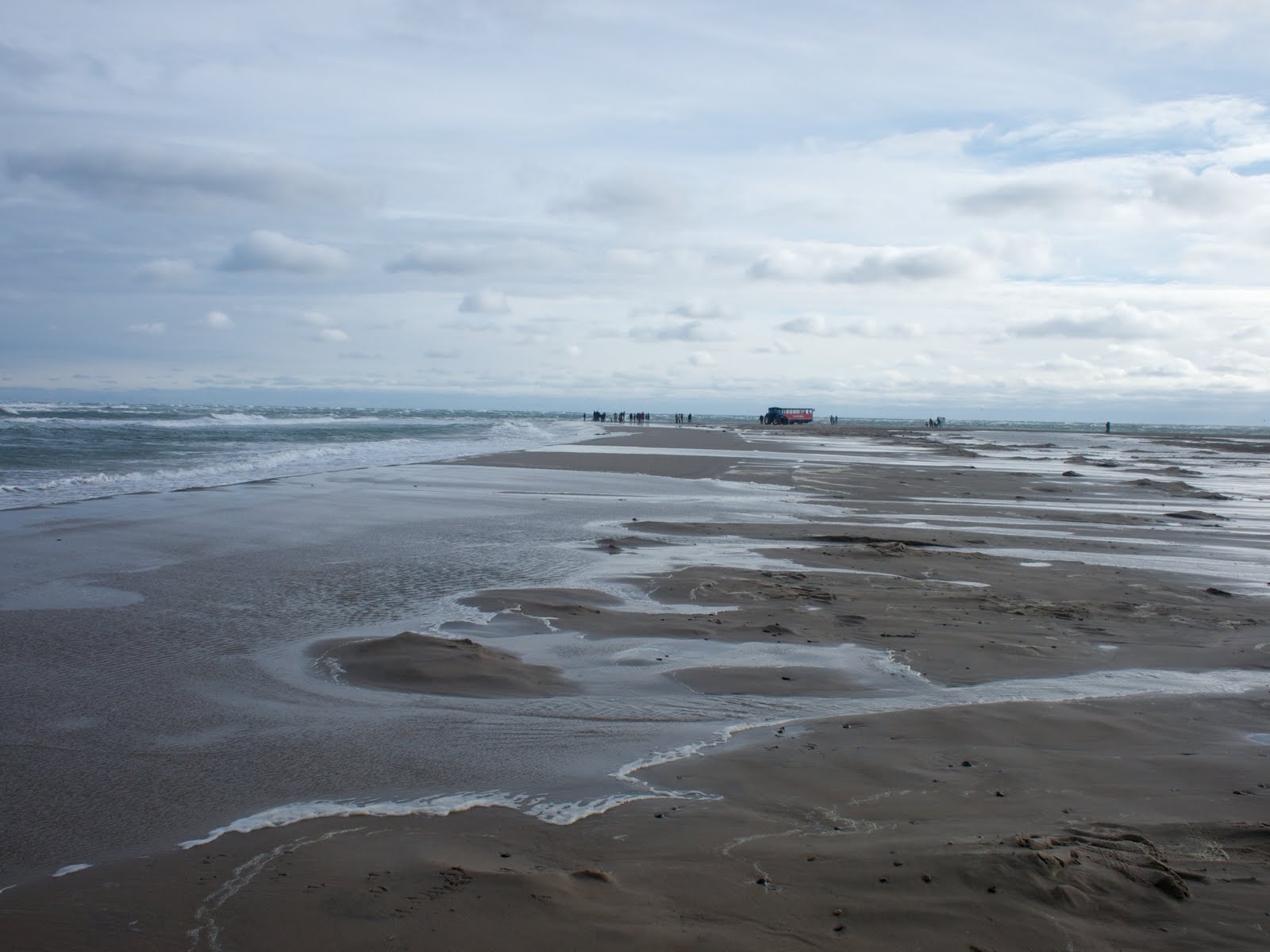
Soon however, I was returned to the reality of bitumen roads that led to Nr. Vorupør a popular tourist destination along with a fish smokery, of interest was the fishing cutters on the beach. These cutters are still used and provide fish for the adjacent Fish smoke house.


Passing through Nr and Sondre Vorupør I headed towards Stenbjerg another small fishing village with its unique beach landing place where the fishing cutters were also launched in days gone by. However, as I followed the trail through the heathlands I noted the old survey mark from the late 1800's apparently used to mark the lifeboat trail.


After Stenbjerg the trail crosses Lyngby Hede which stretches for about 10 km from the outskirts of Stenbjerg to Lodbjerg lighthouse. The afternoon sunshine made for a warm afternoons walk, especially as heading south (with the wind at my back) meant that I was walking into the sun the whole time. approximately halfway across the Hede you enter the village of Lyngby with its old life boat station which can be reserved for overnight accommodation for hikers and cyclists. The Lyngby life boat station is one of approximately 60 lifeboat stations that were placed along the west coast of Jylland.


Leaving Lyngby I returned to the hede for the final 7 kilometres to Lodbjerg Fyr, camp for the night. The lighthouse is located approximately a kilometre back from the coastline. The walk through the heathlands continued to provide a wide variety of scenery with some large sand dunes appearing along the coast line.


The shelter and campsite near the base of Lodbjerg lighthouse reminded me of a wind tunnel and with a sign indicating that 12 persons were staying the night in the shelter or its surrounds I headed to the forest where the was only a slight breeze and a beautiful mossy campsite. As day walkers walked nearby I got many perplexed looks at the tarp and bivy arrangement, no one asked but I am sure they wondered what I was doing there. Having had dinner as the guests with there bags of food and alcohol (it is a 200 metre walk from the parking area) arrived, I decided to go for a stroll around the area safe in the knowledge that the noise of the wind would drown out the sounds of late night revelry.

My neighbours and I awoke to a beautiful morning and whilst my campsite was neat the same could not be said for theirs, but in all fairness they were not that noisy and they did clean the area up as they had breakfast. I set off towards Agger and the peninsula that would take me to the ferry and then the train and then home.


After a short walk through through the heath lands to the shores of Flade Sø I followed the trail around the Sø till it met up with the coast, it was still windy but the sun was warm so the views of the waves breaking, the seagulls playing in the wind made for a pleasant accompaniment to the walk to Agger.


Past Agger the trail follows the Agger Tange a 10 km spit of land which has high sand dunes on the west and flat marsh areas on the east. Out of the wind the warmth of the sunshine could be felt with the many aquatic birds singing it was a relaxing walk. As the trail followed the flat land I would occasionally climb up onto the sand dunes over the sand covered access road to look and admire the sea. It was on one such diversion I was reminded yet again of the man hours spent during world war 2 constructing huge gun emplacements.


Turning away from the trail I followed the bitumen to the ferry to take me across the Kanal, as it is called, to Thyborøn, only to find that it was another 2 km of walking to the railway station (in reality the station is only a raised platform) to catch the Lemvigbanen to the mainline and then another train home. The Lemvigbanen can be best described as an interesting rail service where the conductor uses a mechanical ticket machine similar to that seen on London Buses 30 years ago, the station names are interesting with one being Victoria Street Station. So the end of the trip provide some amusement to what was a very enjoyable walk along the coast. I am already planning the next excursion further up the coast.

Friday, 28 August 2009

Søndersø


For the first time since Jotunheimen I put on my walking boots and went for a walk around one of the local lakes, Søndersø. The trail around the lake is approximately 5.4 km in length and is bordered by the township of Værløse, the now closed military airstrip as well as open farmland and is a popular jogging, walking and cycling path though during week days it is a little quieter.

The trail while mostly gravel does offer some forested sections to walk through, as well as the possibility to see Deer, and listen to the sounds of many different aquatic birds along with pleasant sounds of the Nightingale. The lake is popular fishing spot with many boats moored in an inlet on the lake. It was great to be able to get out for a walk in preparation for an upcoming walk or 2 along the west coast of Jutland.

Friday, 30 May 2008

Drivvejen


Had the opportunity to travel to Jylland in the last couple of days and as a result we were able to spend some time on the Drivvejen, which is a part of the North Sea Trail. Drivvejen starts at Thyborøn and finishes on the Danish German border at Sæd Grænse south of Tønder. The trail is approximately 200 km in length and is a collection of drove ways, some of which were originally established around 800 AD. The trail visits many important historical and geographical places along the way including Ribe, the oldest town in Denmark which was an important market place in the beginning of the eighth century. We hiked only a small section of the trail in the vicinity of Tønder and specifically visited Ribe and Råbjerg Plantage.

The weather has been dry and warm so we were able to explore the many different set ups of our Black Diamond Beta Light. Shown here is one of our favorites which we call star gazing.

Monday, 26 May 2008

Österlenleden, Sweden


The southern part of Sweden contains a number of walking trails over this past weekend we spent some time walking a part of the Österlenleden which initially follows the coast from Ystad in the south to north of Kivik where it turns inland and continues to Snogelholm where it meets up with the Nord till Sydleden (North South trail). The complete walk is 165 km in length and is divided into stages with accommodation suggestions, including tent and shelter sites, provided through out the walk.

We started at Ystad and headed east with the well formed gravel trail following the coast line towards Nybrostrand, the beautiful sandy beaches and the sunny weather made for a pleasant walk, the camping area at Nybrostarnd has all amenities and is a possible overnight stay location. After Nybrostrand there is an artillery range and if the warning flags are flying then a detour around the roads is required this route returns to the coastline at Hammar. After Hammar you arrive at Ales stener ( large stone Viking monument in the shape of a ship) these stones are of 1 to 3 meters in height, and are dated to about 600 AD. From here it is a short walk down to Kåsberga with its fish smokehouse and small shops. After leaving Kåsberga the trail continues along the coast to Löderups strandbad, firstly skirting the township before passing through Backåkra, the former home of UN Secretary General Dag Hammasköld, on our way to the camping site to the east of the township. This quaint campsite has all amenities and as it is adjacent to the nature reserve it provides idyllic surroundings with plenty of places to listen for birds and generally enjoy this quiet hamlet. The heads inland from the campsite and follows the northern boundary of Hagestads naturreservat and passes through lovely stands of forest with occasional glimpses of farmland, it was here that we cam across our first Swedish snake, certainly no where near as dangerous as those in Australia and elsewhere. However, there is an alternative route and that is to walk along the bench, the fine sand makes for easy walking and can be recommended as long as it is not too windy. Either way you ultimately come to Sandhammaren which is supposedly Swedens best sandy beach, according to the signs. The trail now follows the beach north passing many small hamlets before reaching Skillinge a larger village with shopping along with a fish smokehouse. Continuing along the coast you come to Simrishamn, one of the largest fishing ports in Sweden, it has a railway access to Malmo and Ystad. The trail now heads north towards the imposing Stenshuvuds National Park, Sweden's southernmost national park and a truly beautiful place to visit. From the naturum it is a short climb to Stenshuvuds which provides commanding views of the surrounds and is the site of a fort which dates back to around 600 AD. Soon after leaving Stenshuvuds you arrive in the small fishing hamlet of Kivik with its modern fish smoke house as well as wonderful organic foods shop. Kivik is the site of the apple festival in late August. This was where our trip concluded, however, we will back. Detailed information on hiking trails in the Skane area can be found at www.skaneleden.se

Monday, 5 November 2007

ALONG THE NORDSØSTIEN (North Sea Trail Denmark): Ebletoft to Grenaa


As I travelled on the Bus number 888 from Valby Station to Sjællands Odde and then to Ebeltoft Ferry station. I reflected on my previous trip along the Nordsøstien, this time I wanted to complete the section from Ebletoft to Grenå a walk of about 40 km (see GPS waypoints and details here).


After leaving the ferry port the Nordsøstien follows H H Hansens Vej past the 4 wind turbines which dominate the skyline the trail soon enters the grassland before turning onto the beach and the firm sand makes for pleasant walking as you approach Ahl Plantage after walking along the beach for a little over 2 km. The trail then meanders through the plantage taking in the variations of the forest and according to the Ebeltoft Kommune brochure it is possible to view the Yellow Ants. The trail through the plantation ultimately takes you to a bike path that you will follow into the township of Ebeltoft. Within the township of Ebeltoft there are many opportunities for purchasing food as well as camping equipment. The Glasmuseet (Glass Museum) and the Fregatten Jylland the largest wooden ship in the world according to the website. There is also an information centre in near the trail which can provide information on the trail along with possible accommodation in Ebeltoft. The trail follows the shoreline as it heads North out of Ebeltoft towards Ebeltoft Strand Camping which provides a option of staying all year round. After passing through Ebeltoft Strand Camping the trail turns towards Route 21 and after crossing Route 21 it follows a minor road before meeting up with Banestien which is the former Ebeltoft Trustrup railway line. The trail now follows this railway line through Skæso Plantage to meet up with Molsruten at Stubbe Stovej (Molsruten which runs from Aarhus to Grenå is part of the European Union E1 trail running from Scapoli in Italy to Varberg in Sweden a total of 4900 km. more information about Molsruten can be found here ).


The Molsruten and the Nørdsostien follow the same alignment all the way to Grenå, some 28 km away. After crossing Stubbe Stovej the trail continues past a low lying area which was full of water when I passed through in October. The trail meets up with Stubbe Stovej again and it is at this point you leave the Banestien and turn east along the bitumen road. You follow Stubbe Stovej till you meet up with Ved Fredskoven a private road linking Stubbe Stovej with Gamle Mejerivej, this private road takes you through farmland and forest and provides easy walking through undulating country. The trail veers left onto Gamle Mejerivej heading in a northerly direction before turning east along Bjergenvejen for before it meets up with Stenledvej which will take you south west to Rugårdsvej which will lead you north to the sign-posted turn to Rugårds Camping a large holiday camping area overlooking Kattegat. The trail passes through the camping park parallel to the foreshore after which a trail will continue to take you north following the coastline all the way to Grenå.


The walk along the coast line is pleasant, and whilst at times the sand and or gravel can slow progress there are many opportunities to walk on foot trails that parallel the coast. One such place is Glatved strand where there is a working gravel pit along with informative signs advising of the importance of the gravel dating back to prior to the Second World War. I enjoyed this section of the trail as it provided a respite from the road walking that I had experienced earlier and apart from the occasional fisherman I was able to spend a lot of time just admiring the scenery and the wild life that can be found in the area. Perhaps one of my most enjoyable tarping and bivvying experience occurred on this particular section of trail.